The Babylonian Map of the World
- ThaoMy
- June 11, 2025
The Babylonian Map of the World, created around the 6th century BC, is one of the earliest known attempts to represent the Earth in cartographic form. This clay tablet, inscribed with cuneiform script and now housed in the British Museum, provides a symbolic and geographical depiction of the world as understood by the ancient Babylonians. It places Babylon at the center, surrounded by a circular landmass representing the known world, encircled by a “bitter river” or ocean.

The map combines mythological and real geographical elements, illustrating the Babylonians’ cosmological worldview. Various regions and cities such as Assyria and Urartu are labeled, while mysterious outer regions are depicted as “islands” beyond the ocean, possibly referencing distant or imagined lands. The blending of fact and myth reveals the Babylonians’ efforts to organize and understand their world using both observation and religious belief.
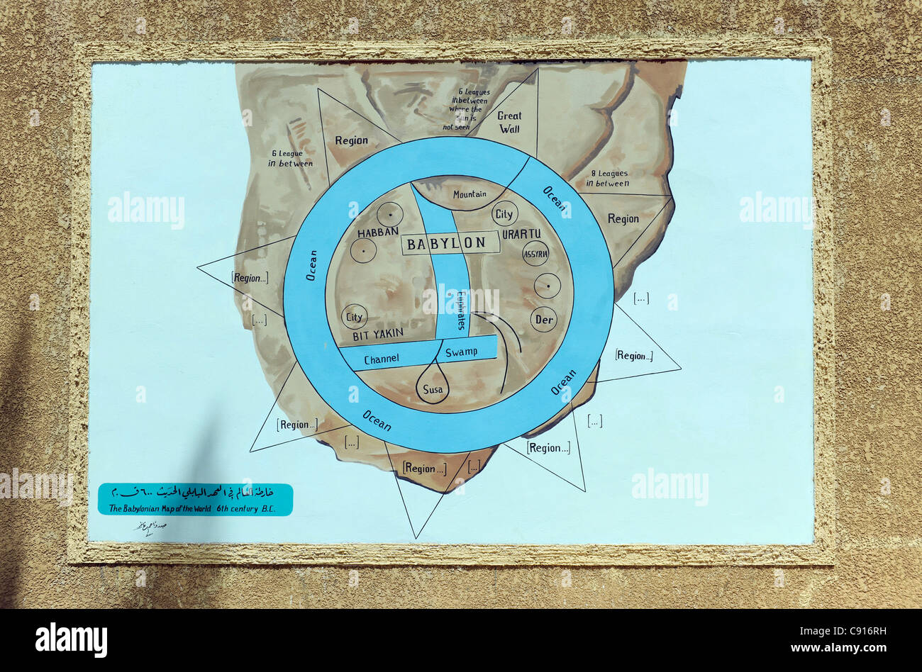
This artifact is significant not only as a cartographic tool but also as a cultural and historical document. It demonstrates how early civilizations attempted to make sense of their surroundings and their place in the universe. The Babylonian Map of the World marks an important step in the history of geography, showing humanity’s long-standing desire to explore, explain, and represent the world.
